Netflora
December 19, 2024 · View on GitHub

Read this in other languages: Português, Español.
![]()
The Netflora Project involves the application of geotechnologies in forest automation and carbon stock mapping in native forest areas in Western Amazonia. It is an initiative developed by Embrapa Acre with sponsorship from the JBS Fund for the Amazon.
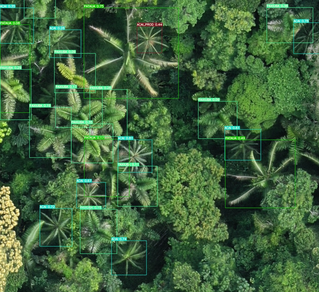
Here we will discuss the "Forest Inventory using drones" component. Drones and artificial intelligence are used to automate stages of the forest inventory in identifying strategic species. More than 50,000 hectares of forest areas have already been mapped with the goal of collecting information to compose the Netflora dataset.
Running the Detection
!python detect.py --device 0 --weights model_weights.pt --img 1536
Visualizing Detection Results
!python results.py --graphics --conf 0.25
Examples of Detection by Algorithms


Website
https://www.embrapa.br/acre/netflora
Citation
License
Distributed under the GPL 3.0 license. See LICENSE for more information.
Useful Links
- Orthophoto example download
- EAD Course
- Frequently Asked Questions (FAQ)
- Embrapa Acre
- JBS Fund for the Amazon
We appreciate your interest for the Netflora project!