tui-globe
May 30, 2026 · View on GitHub
A ratatui Braille-canvas globe widget. Geometry buffers under assets/geo/
are baked from public domain Natural Earth
data and embedded at compile time via MapData::embedded().
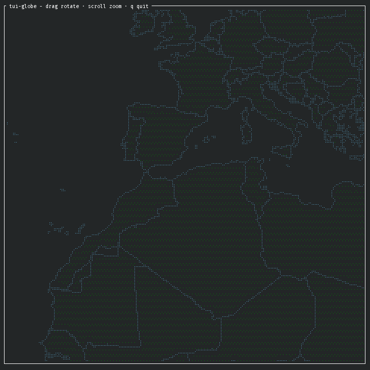
Demo app
cargo install tui-globe
or
make build
Regenerating the geometry
The .gl buffers are generated by tools/build_geo.py. The script fetches
shapefiles from naciscdn.org on demand, caches them, and writes the five
.gl blobs to --out. The buffers are checked in, so you only need to
re-run the script when bumping the data set or changing the build flags.
Run it
The script is packaged as a Python project at tools/pyproject.toml,
declaring pyshp, mapbox-earcut, and numpy as dependencies. Pick
whichever workflow you prefer:
- With
uvuv run --project tools build-geo --scale 50m --out assets/geo - With
pipcd tools python3 -m venv .venv .venv/bin/pip install -e . .venv/bin/build-geo --scale 50m --out ../assets/geo
Flags
| flag | default | meaning |
|---|---|---|
--scale {10m,50m,110m} | 50m | Natural Earth resolution. Smaller numbers = denser mesh / larger binary. |
--cultural-borders | default | With borders, triangulate ne_<scale>_admin_0_countries (coastlines + country borders) and overlay ne_<scale>_admin_1_states_provinces_lines. |
--no-cultural-borders | not default | Without, triangulate ne_<scale>_land (coastlines only). |
--data-dir PATH | $XDG_CACHE_HOME/tui-globe-build-geo | Where to cache downloaded .zip/.shp files. |
--out PATH | (required) | Output directory for the five .gl files. |
--ne-countries PATH | auto-fetch | Override: custom admin_0_countries .shp (cultural mode). |
--ne-states PATH | auto-fetch | Override: custom admin_1_states_provinces_lines .shp (cultural mode). |
--ne-land PATH | auto-fetch | Override: custom physical land .shp (--no-cultural-borders mode). |
The override flags let you swap in locally modified shapefiles (e.g. simplified geometry, custom border tweaks). They take precedence over auto-fetch for that one input; the rest still come from the cache or are downloaded.
Examples
# Default: 50m with country and state/province borders
build-geo --scale 50m --out assets/geo

# High-detail land mesh with no borders
build-geo --scale 10m --no-cultural-borders --out assets/geo

# Tiny global-overview mesh
build-geo --scale 110m --out assets/geo

# Use custom / locally modified shapefiles (overrides auto-fetch)
build-geo --scale 50m \
    --ne-countries ./my-data/ne_50m_admin_0_countries.shp \
    --ne-states    ./my-data/ne_50m_admin_1_states_provinces_lines.shp \
    --out assets/geo

# Override just the country polygons; states still auto-fetched
build-geo --scale 50m \
    --ne-countries ./my-data/custom_countries.shp \
    --out assets/geo

# Custom physical-land shapefile, no borders
build-geo --no-cultural-borders \
    --ne-land ./my-data/custom_land.shp \
    --out assets/geo
Verify
make check
Geometry format
Five little-endian binary blobs:
| file | dtype | meaning |
|---|---|---|
land_positions.gl | f32 xyz | unit-sphere vertices |
land_triangle_indices.gl | u32 | GL_TRIANGLES indices |
land_contour_indices.gl | u32 | GL_LINE_STRIP indices, 0xFFFFFFFF between rings |
ocean_positions.gl | f32 xyz | level-4 icosphere vertices (2562) |
ocean_indices.gl | u32 | GL_TRIANGLES indices (5120 tris) |
Coordinate convention used by lib.rs::project_point:
x = cos(lat) sin(lon)
y = sin(lat)
z = cos(lat) cos(lon)
License
- Copyright d10n
and any potential future contributors (see AUTHORS). - Code is licensed under
GPL-3.0-or-later. See./LICENSES/GPL-3.0-or-later.txt. - Map data is derived from Natural Earth which is public domain or
CC0-1.0. See./LICENSES/CC0-1.0.txt.